Connect With Us
![]()
![]()
![]()
Projects & Programs - Watershed Planning & Implementation
Tenakill Watershed Restoration & Protection Plan, Bergen County, NJ
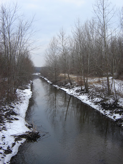
Based upon the New Jersey Department of Environmental Protection (NJDEP) Ambient Biomonitoring Network (AMNET) data and data collected by the NJDEP/United States Geological Survey (USGS), the Tenakill Brook is impaired for aquatic life and arsenic and is listed on Sublist 5 of the New Jersey 2004 Integrated Water Quality Monitoring and Assessment Report. Additionally, a Total Maximum Daily Load (TMDL) for fecal coliform has been proposed for 10.2 miles of stream. This TMDL requires a 96% reduction in nonpoint source (NPS) bacteria loads from this residential watershed. The goal of this project is to improve the water quality of the Tenakill Brook by developing a Watershed Restoration Plan that achieves the required TMDL reductions and reduces the NPS pollutant loading that is contributing to the aquatic life impairments so that water quality standards may be met.
This watershed-based plan will:
-
identify the causes and sources that will need to be controlled to achieve the load reductions that are estimated as part of this watershed-based plan;
-
estimate the load reductions expected for the management measures that are identified as part of this watershed-based plan;
- identify NPS management measures that will need to be implemented to achieve the load reductions estimated as part of this watershed-based plan;
- identify critical areas for the implementation of these NPS management measures;
- estimate the amounts of technical and financial assistance needed to implement the plan;
- identify potential sources of funding to implement each management measure that is identified in the plan;
- outline an informational/educational plan to enhance public understanding of the project and encourage early and continued participation in implementing the plan;
- develop a ranking system to identify where resources should be targeted;
- provide a schedule for implementing the NPS management measures that are identified in the plan;
- outline a set of criteria that can be used to determine whether load reductions are being achieved over time and if substantial progress is being made toward attaining water quality standards, and
- detail a monitoring component to evaluate the effectiveness of the implementation efforts over time.
Deliverables:
Tenakill Brook Watershed Restoration and Protection Plan: Data Report, July 2011
Tenakill Brook Watershed Restoration & Protection Plan, July 2012
- Restoration Plan - Appendix A - ROOSEVELT COMMONS SHORELINE
RESTORATION PROJECT- Restoration Plan - Appendix B - SITE SPECIFIC NONPOINT SOURCE
MANAGEMENT MEASURES FOR MUNICIPALITIES IN THE TENAKILL BROOK WATERSHED- Restoration Plan - Appendix C - PROJECTS TO ADDRESS KNOWN WATER QUALITY IMPAIRMENTS IN THE TENAKILL BROOK WATERSHED
- Restoration Plan - Appendix D - ENGINEERING PLANS FOR IMPLEMENTATION PROJECTS TO ADDRESS KNOWN WATER QUALITY IMPAIRMENTS IN THE TENAKILL BROOK WATERSHED
Project Funding Source: NJDEP 319(h)
Contacts:
Christopher C. Obropta, Ph.D., P.E.
Associate Extension Specialist
Rutgers Cooperative Extension
Water Resources Program
14 College Farm Road
New Brunswick, NJ 08901
obropta@envsci.rutgers.edu
848-932-5711Project Partners:
• Bergen County Department of Health Services • Fairleigh Dickinson University • United Water New Jersey
• Alpine Borough • Closter Borough • Cresskill Borough • Demarest Borough • Dumont Borough • Englewood City • Haworth Borough • Tenafly Borough